![]()
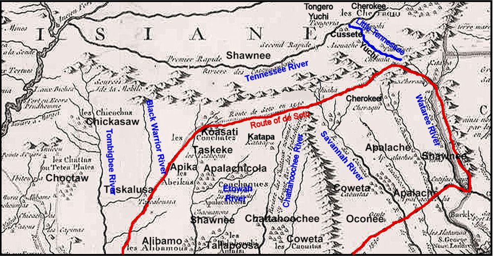 Detail of the 1717 map of Louisiana by Guilluame Delilse. This map followed the first round of the Creek-Cherokee War In 1717. It was one of the first European maps to use a name similar to Cherokee. The label Kofitachete ("Mixed Race People" in Itsate Creek) - found on earlier European maps - was changed to Charakee. The Kusate Creeks and the Yuchi were still on the Little Tennessee River, but they would be gone by 1725. The Tuskegee Creeks had already moved from the Smoky Mountains to the Coosa River. The Apalachicola no longer lived in north-central Georgia. The Little Tennessee River Shawnees had been pushed down to the Lower Coosa River. Still all of the Etowah River Valley was densely populated with Apalachicola villages. They would remain there until sometime between 1763 and 1776. Georgia archaeologists have consistently labeled their villages “Historic Cherokee.” DeLisle's path for de Soto differs a bit from routes proposed by contemporary scholars. Read full Story |
© 2012 - 2024
People of one
Fire
Webmaster
(site problems only)